
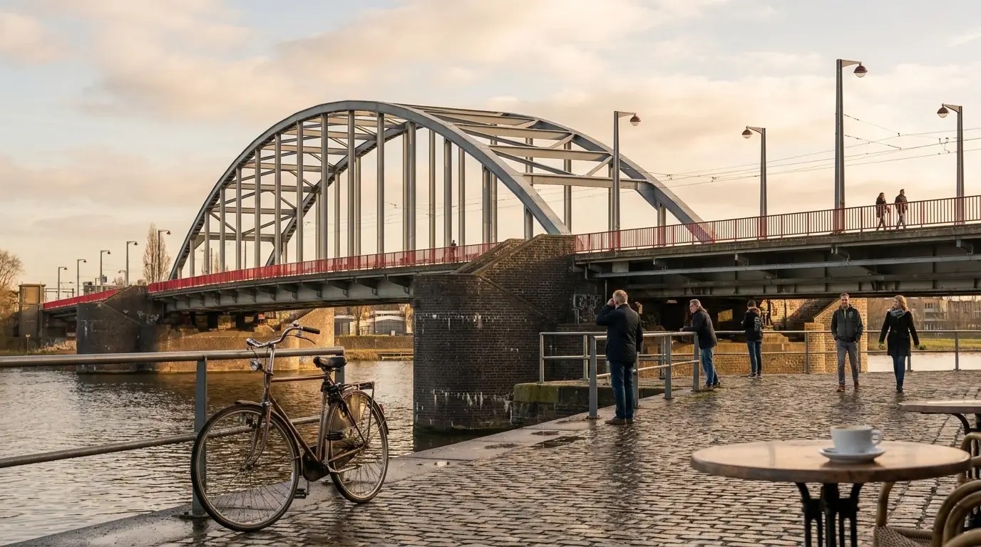
Arnhem Heritage Walk: Stones That Survived the Bridge

120 min
2.0 km

10 stops
About this tour
After September 1944 the city rebuilt around a bridge that was lost and replaced. A self-guided centre walk with quizzes in the StepQuests app, from the north-bank span to the stones that survived.
Itinerary
10 guided stops on this route
Airborne at the Bridge
The quay is public. The pavilion is free when the door is open. Rijnkade 150, 6811 HD. Daily 10:00-17:00 until 27 September 2026. Closed from 28 September 2026…

John Frostbrug
Public quay. No ticket for the north-bank view. John Frostbrug, Arnhem. Built 1932-1935 as the Rijnbrug, opened to traffic 10 April 1935. Destroyed 1940, again…
Walburgiskerk
Public square. The towers are apartments, not a visitor attraction. Sint Walburgisplein 1, 6811 BZ. Chapter from Tiel, 1315. Church in use around 1375. Burned…
Sabelspoort
Public passage. No ticket for the gate. Markt 12, 6811 CG. First recorded 1357. City-side facade 1642 by Arien Verhoeff. Restored after war damage 1952-1953. N…
Huis der Provincie
The Markt facade is public. The offices are a working provincial house. Markt 11, 6811 CG. Designed by J.J.M. Vegter with Henk Brouwer, built 1950-1955, opened…
Markt
Public square. No ticket. Markt, Arnhem. Enlarged in the postwar rebuild so Eusebius and Huis der Provincie face each other. The Waag at Markt 38 sits on the n…

Best with friends
Play together to compare scores, discuss clues, and share the moments. Great for friends, families, and team outings.
Frequently asked questions
What's included

GPS-guided walking route
Interactive quizzes at each stop
Fascinating stories and facts
Lifetime access to the tour
Tags

Buy on the web
Pay securely in your browser, then open the app with the same email to access your tour.
After payment, open the app and sign in with the same email to access your tour.

Get the App
Download Step Quests to start this walking tour. GPS, stories, and a quiz at each stop.


Turn-by-turn navigation

Location-based content unlocking

Score points and earn achievements

Requires internet for GPS, maps, and unlocking content